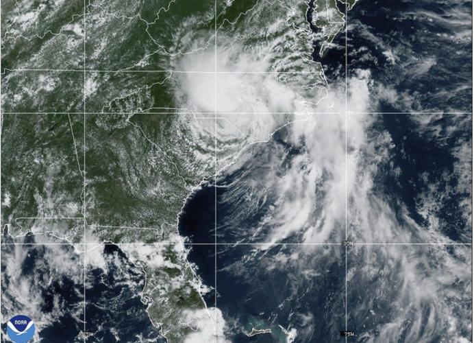


CHAPEL HILL, N.C. (AP) — Heavy rain and flooding from the remnants of Tropical Storm Chantal forced dozens of people to flee their homes in central North Carolina, officials said Monday.
The Chapel Hill Fire Department and neighboring agencies completed more than 50 water rescues, many of them in areas where floodwaters entered or threatened to enter apartments, officials said. More than 60 people were displaced Sunday and Monday.
There were also water rescues at shopping centers, where water flooded businesses and parking lots, officials said. There were no reports of injuries as of Monday morning. Officials warned residents to take care as they ventured out Monday morning since crews were still assessing damage.
In Orange County, the possibility of the failure of the Lake Michael Dam prompted officials to issue a voluntary evacuation for areas downstream overnight.
In Chatham County, Sheriff Mike Roberson warned residents in a social media post that water may have subsided in some areas, but it was still dangerous to travel. Officials were searching for some missing people Monday morning, he said.
All lanes of Interstate 85/Interstate 40 were closed both directions Monday near Durham and were expected to reopen in 24 to 48 hours, according to the North Carolina Department of Transportation.
The Eno River crested early Monday at Durham at 25.63 feet (7.81 meters), surpassing the previous record of 23.6 feet (7.19 meters), according the ��ɫֱ�� Water Prediction Service’s website.
The Haw River crested early Monday at 32.5 feet (9.91 meters), the second highest river stage ever recorded at the Town of Haw River. That level was only eclipsed by Hurricane Fran in 1996 when the stage reached 32.83 feet (10.01 meters), according to a post from the ��ɫֱ�� Weather Service’s Raleigh office.
More than 34,000 customers were without power on Monday morning, according to .
Chantal was expected to continue northeast through mid-Atlantic states Monday as a tropical depression before brushing the southern New England coast Monday night into Tuesday morning, according to the Weather Prediction Center.
Rainfall amounts of up to 10 inches (25 centimeters) have already been reported in portions of the interior mid-Atlantic and the possibility of 3 to 6 inches (8 to 15 centimeters) more was expected to raise flash flooding concerns, particularly to the northwest of Chantal’s path through Monday night.
was downgraded to a depression Sunday after making landfall near Litchfield Beach, South Carolina, early Sunday, the ��ɫֱ�� Hurricane Center in Miami said.
Forecasters warned of dangerous surf and rip currents at beaches from northeastern Florida to the mid-Atlantic states for the next couple of days.