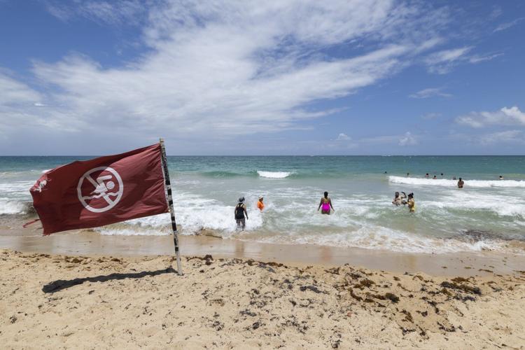
A warning flag flies on the beach as people swim in Condado, Puerto Rico, as Hurricane Erin approaches, Friday, Aug. 15, 2025. (AP Photo/Alejandro Granadillo)
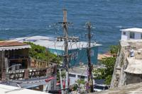
Power lines and utility poles stand in front of La Perla neighborhood along the coast in Old San Juan, Puerto Rico, as Hurricane Erin approaches, Friday, Aug. 15, 2025. (AP Photo/Alejandro Granadillo)
A woman poses for photos next to a Puerto Rican flag along the beach in Condado, Puerto Rico, as Hurricane Erin approaches, Friday, Aug. 15, 2025. (AP Photo/Alejandro Granadillo)
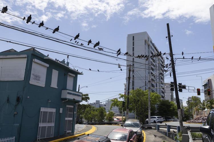
Pigeons perch on power lines in Santurce, a neighborhood in San Juan, Puerto Rico, as Hurricane Erin approaches, Friday, Aug. 15, 2025. (AP Photo/Alejandro Granadillo)
A warning flag flies on the beach as people swim in Condado, Puerto Rico, as Hurricane Erin approaches, Friday, Aug. 15, 2025. (AP Photo/Alejandro Granadillo)
RE
Power lines and utility poles stand in front of La Perla neighborhood along the coast in Old San Juan, Puerto Rico, as Hurricane Erin approaches, Friday, Aug. 15, 2025. (AP Photo/Alejandro Granadillo)
RE
A woman poses for photos next to a Puerto Rican flag along the beach in Condado, Puerto Rico, as Hurricane Erin approaches, Friday, Aug. 15, 2025. (AP Photo/Alejandro Granadillo)
RE
Pigeons perch on power lines in Santurce, a neighborhood in San Juan, Puerto Rico, as Hurricane Erin approaches, Friday, Aug. 15, 2025. (AP Photo/Alejandro Granadillo)
RE
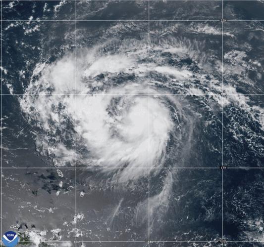
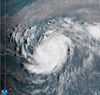
This satellite image provided by NOAA shows Hurricane Erin on Friday, Aug. 15, 2025. (NOAA via AP)
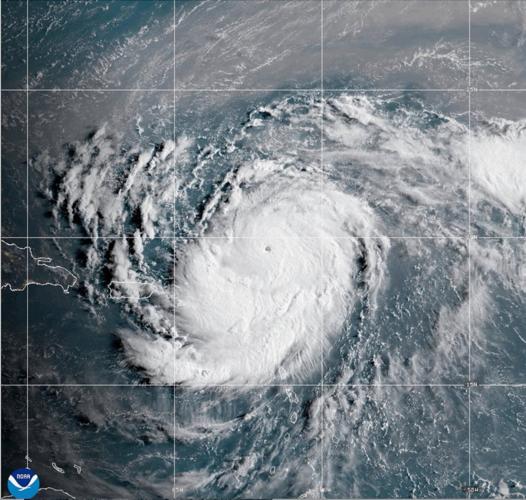
This satellite image provided by NOAA shows Hurricane Erin on Saturday, Aug. 16, 2025. (NOAA via AP)
SAN JUAN, Puerto Rico (AP) — Erin strengthened into a powerful Category 4 hurricane in the Caribbean on Saturday and continues to intensify, the ´şÉ«Ö±˛Ą Hurricane Center said.
is currently 150 miles (240 kilometers) northeast of Anguilla with maximum sustained winds of 145 mph (230 kph). It is moving west-northwest at 20 mph (31 kph).
It is currently not forecast to hit land, but strong winds are affecting nearby islands, prompting forecasters to warn of possible flooding, landslides and mudslides. The Hurricane Center said it will eventually swerve away from the continental United States.
Tropical storm watches are in place for St. Martin, St. Barts and St. Maarten.
"The outer bands of Erin are expected to produce areas of heavy rainfall through Sunday across the northern Leeward Islands, the Virgin Islands, and Puerto Rico,” the center said. The currently “compact” storm is expected to grow in size in the coming days, resulting in rough ocean waters over the western Atlantic.
Hurricane specialist and storm surge expert Michael Lowry said Erin is forecast to eventually take a sharp turn northeast that would put it on a path between the U.S. and Bermuda.
“All of our best consensus aids show Erin turning safely east of the United States next week, but it’ll be a much closer call for Bermuda, which could land on the stronger eastern side of Erin,” he said.
Protruding U.S. coastal areas — such as North Carolina’s Outer Banks, Long Island, New York, and Cape Cod, Massachusetts — face a higher risk of direct and potentially severe tropical storm or hurricane conditions than much of the southern Atlantic, mid-Atlantic and northern New England coasts, Accuweather said.
Erin is the fifth named storm of the Atlantic hurricane season, which runs from June 1 to Nov. 30, but the first to reach hurricane status.
This year’s season is once again . The forecast calls for six to 10 hurricanes, with three to five reaching major status with winds of more than 110 mph (177 kph).
The U.S. government has deployed more than 200 employees from the Federal Emergency Management Agency and other agencies to Puerto Rico as a precaution as forecasters issued a flood watch for the entire U.S. territory from late Friday into Monday.
The U.S. Coast Guard said Friday that it closed six seaports in Puerto Rico and two in the U.S. Virgin Islands to all incoming vessels unless they had received prior authorization.
Meanwhile, officials in the Bahamas said they prepared some public shelters as a precaution as they urged people to track the hurricane.
“These storms are very volatile and can make sudden shifts in movement,” said Aarone Sargent, managing director for the Bahamas’ disaster risk management authority.